KOYUNBABA DAM
Proje: s0500-suyapilari
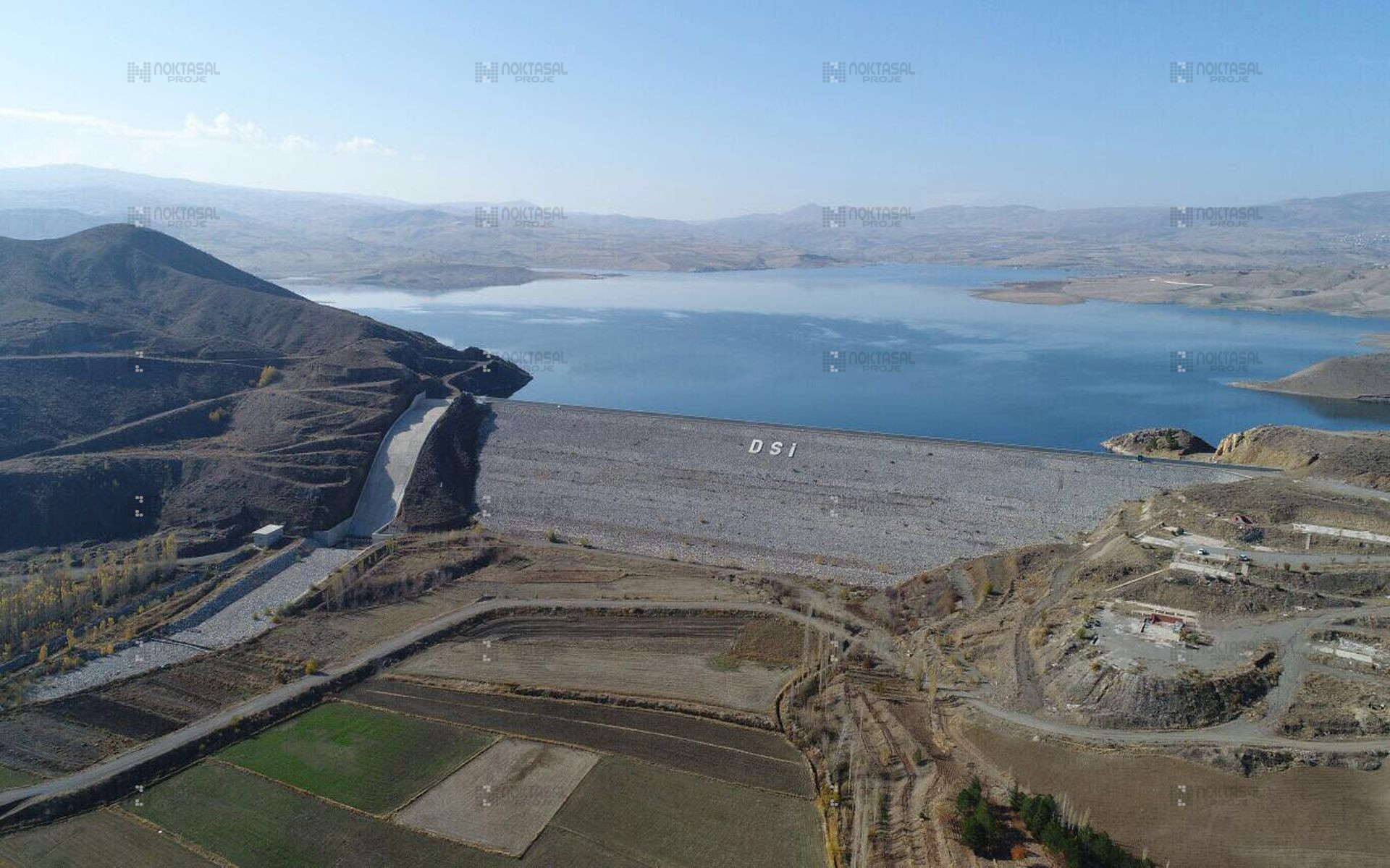
Koyunbaba Dam
Koyunbaba Dam and lake area is located on Terme Stream within the borders of Ankara Kalecik district. It is located 60 km northeast of Ankara, 27 km north of Kalecik District and 25 km northeast of Çubuk District.
Hydrology
- Rainfall area: 754 km²
- Annual average flow: 60.02 x 10⁶ m³ (between 1969-2003)
- Annual average flow: 1.90 m³/s
- Monthly minimum flow: 0.05 x 10⁶ m³ (monthly min. average flow 1.6 l/s)
- Average amount of water withdrawn from the dam for irrigation: 50.80 x 10⁶ m³/year
- Regulation ratio: 84.64%
Reservoir
- Minimum operating water level: 810.00 m
- Normal water level (N.S.S.): 838.80 m
- Maximum water level: 841.35 m
- Reservoir area in N.S.S: 13.34 km²
- Reservoir area at minimum operating level: 2.50 km²
- Reservoir volume in N.S.S: 228.81 x 10⁶ m³
- Min. reservoir volume at operating level: 18.03 x 10⁶ m³
- Active volume: 210.78 x 10⁶ m³
- Reservoir level change: 28.80 m
Dam Body
- Dam type: Concrete-faced sand-gravel filling
- Dam crest elevation: 839.85 m
- Parapet wall top elevation: 841.85 m
- Dam thalweg elevation (approx.): 790.50 m
- Dam height from thalweg: 49.35 m
- Dam height from foundation: 51.35 m
- Dam crest width: 8.00 m
- Total body volume (including intermediate fill and cofferdams): 1,697,752 m³
- Clay fill volume: 34,832 m³
- Concrete volume: 31,386 m³
- Permeable material volume: 274,203 m³
- Filter volume: 277,452 m³
- Riprap volume: 6,830 m³
- Body upstream slope (vertical:horizontal): 1:1.70
- Body downstream slope (vertical:horizontal): 1:1.70
Spillway
- Spillway location: Right bank
- Spillway type: Front intake, without gate
- Project flood peak: 824.19 m³/s
- Outflow rate after offset: 256.36 m³/s
- Approach channel length: 10 m
- Approach channel width: 30 m
- Approach channel bottom elevation: 837.30 m
- Discharge channel length: 116 m
- Discharge channel width: 25 m
- Drop pool length: 20 m
- Spillway crest elevation: 838.80 m
- Spillway crest length: 30 m
Derivation
- Diversion tunnel location: On the right bank
- Diversion tunnel type (circular section): Double reinforced concrete lined
- Diversion tunnel inner diameter: 3.00 m
- Diversion tunnel length: 360.87 m
- Derivation tunnel entrance base level: 793.75 m
- Derivation tunnel exit base level: 789.02 m
- Tunnel capacity: 52.70 m³/s